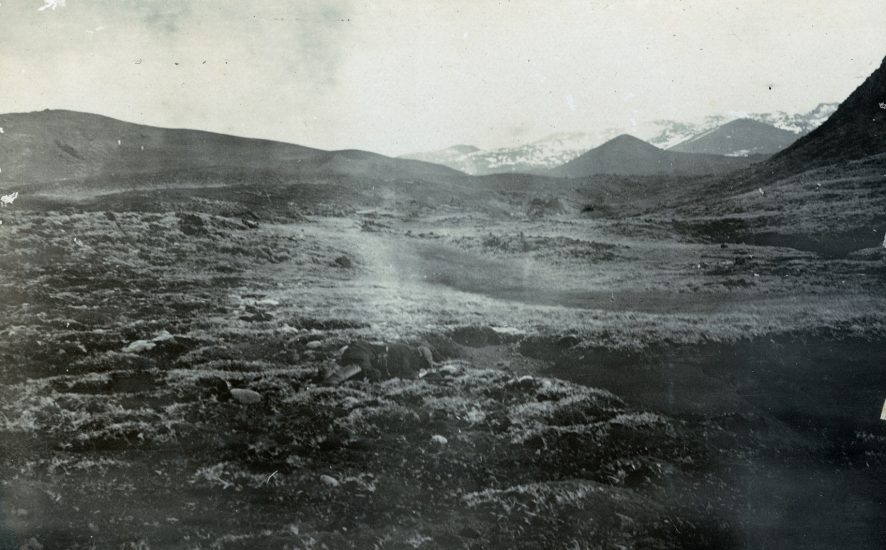
Feature photograph: An inland view of Marion Island, taken by Anders Harboe-Ree in October/November 1908; the earliest-known landscape photograph taken at the Prince Edward Islands
On 16 October 1908 the Norwegian sealing vessel Solglimt hit an uncharted rock off Marion Island’s north-eastern coast and was deliberately grounded in Ship’s Cove in a sinking condition by its young Captain, Anders Harboe-Ree, then only 27 years old.
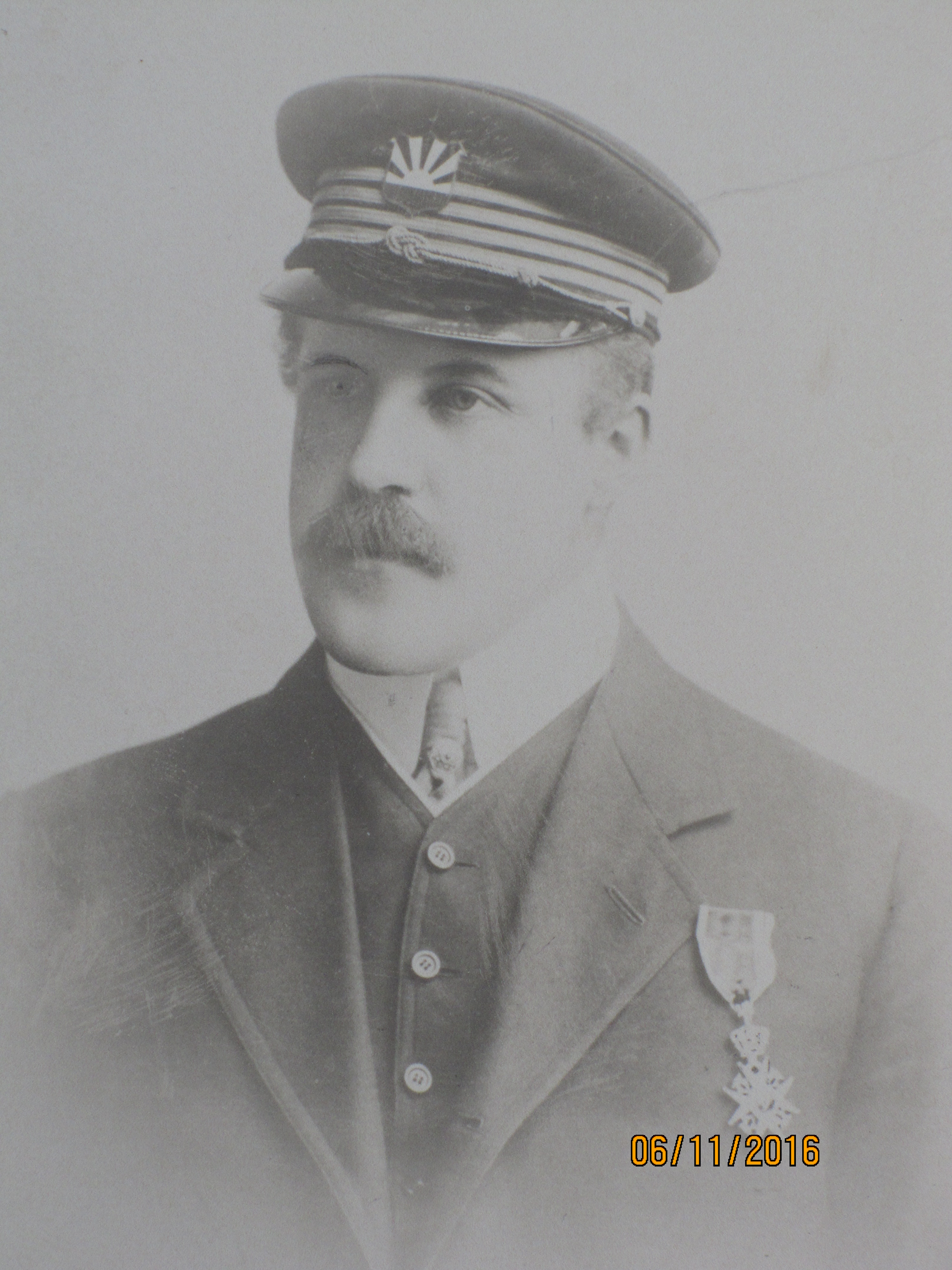
Captain Harboe-Ree and his crew spent a month ashore living in huts they had built in the valley above Ship’s Cove until rescued by two Nova Scotian sealing schooners. The Captain had a camera with him and during his time on Marion took a number of photographs, including two of his wrecked ship (click here). He also recorded in an article he wrote in Durban, South Africa after rescue to the Norwegian newspaper Morgenbladet that he went for an inland walk.
“One Sunday I was off myself. Not only to search for precious stones, but to see the island. When you start walking into the island, you realise how big Marion Island is, and the farther you go the wilder the nature gets. The island is of volcanic origin and consists of lava and annealed stones which have been ejected out of the ground in the most peculiar shapes. There are lots of craters from burnt-out volcanoes and several places the lava looks like petrified rivers which have suddenly stopped in their flow.” (in translation).
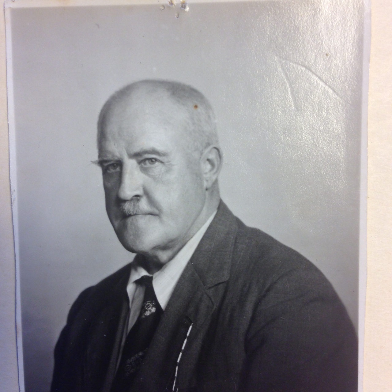
By kind courtesy of the Captain’s grand-daughter, Cathrine Harboe-Ree, the Antarctic Legacy of South Africa has obtained digital copies of the photographs he took on Marion Island, some of the very earliest ever taken at the Prince Edward Islands. One of these is the landscape view featured here. With the help of the Marion Island Facebook Page the general locality from where the photo was taken has been worked out and the features identified as described below (note the original hi-quality 23.9-mb TIFF image was used for this purpose).
Photograph description
In the far background Piew Crags is discernible as a pale line on the horizon in the photo’s centre with Katedraalkrans and First Red Hill clearly recognizable to the right. The slope on the right is Long Ridge roughly between the Second and Third Sister (where it gets steep). The hill below First Red Hill is the First Sister. The gentle slope on the left must be the western flank of Second Sister (which has such a gently-sloping extension). More clearly visible on the hi-qual is a prone figure in the foreground, seemingly reaching below ground, perhaps into a bird burrow.
Note I lined up these features on the map to confirm they all fit. Going for a walk from Ship’s Cove the Solglimt‘s Captain could have gone along the coast to Sealer’s Beach and then headed inland along the eastern flank of Long Ridge: reasonably easy going.
ALSA would now like someone on the island to go for a walk on a clear day and try to find the spot where Harboe-Ree stood and then to take GPS co-ordinates and a photograph or two to match the Captain’s 1908 view.
With grateful thanks to Cathrine Harboe-Ree, Librarian, Monash University, Melbourne, Australia and Henrik Harboe-Ree, Norway.
John Cooper, Antarctic Legacy of South Africa, Department of Botany and Zoology, Stellenbosch University, South Africa, 14 November 2016