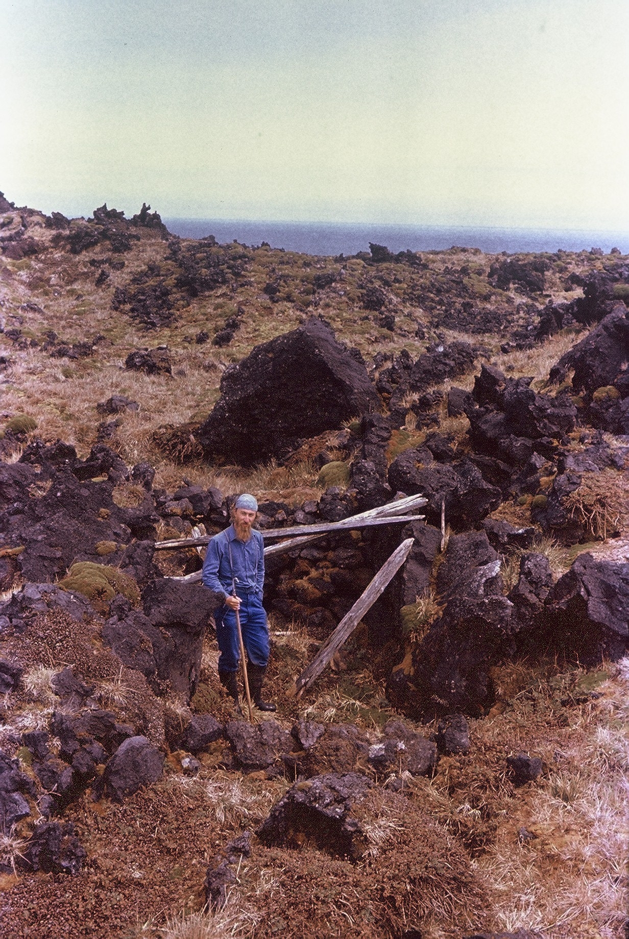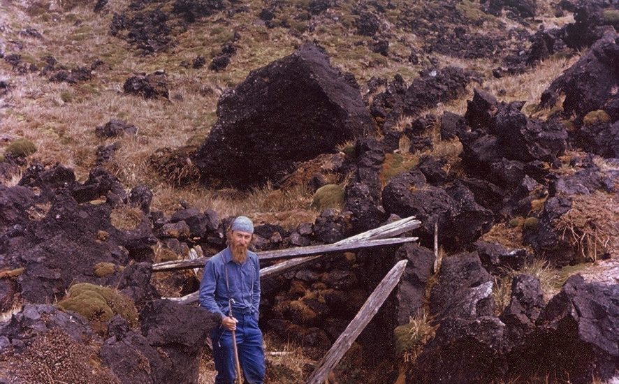
Greg Hofmeyr stands within the shelter below Laekop in 1992. The piled-up rock wall behind him and the few planks that may have made or held up a roof are visible
In the north-western corner of Marion Island lies the Devil’s Footprint. A region of tumbled and partially vegetated black lava ridges running down to the coast between Cape Davis and Triegaardt Bay, it is little visited, being off the usual round-island route and away from the more notable seabird colonies and seal aggregations. A little distance above these ridges is Laekop, a red scoria mound where in the cat shooter days a ski cabin was located nearby, and which lies on one of the more commonly hiked routes between the field huts situated near Cape Davis and Mixed Pickle Cove.
Below Laekop but some distance from the sea among the black lava, lies a little-known historical site, dating prior to South Africa’s annexation of the Prince Edward Islands in 1948. What is thought to be this site was first described by biologist R.W. ‘Bob’ Rand who was on the island with the Eighth Team (M8) over the summer of 1951/52. He reported the remains of a shelter with planks and pottery north of Triegaardt Bay but did not leave a description of the site’s locality.
Marthán Bester (M33, M38 & M43, 1976, 1981 & 1986) also came across a historical site away from the coast below Laekop while on a round-island in October/November 1976. Marthán remembers seeing some canvas at the site he found. Around a decade later the cat shooters walked just about the whole island and a historical site in the general vicinity was then known as has been reported to the Antarctic Legacy of South Africa by André Botha (M46 &M47, 1989-1990).
Frustratingly, no photographs have come to light until very recently when Greg Hofmeyr (M49, M51 & M63, 1992, 1994 & 2003) contacted ALSA with the picture illustrated here, taken in 1992 about halfway between Laekop and the coast. Greg describes a stone wall, about 1.5 m high, which is visible behind him in the photo, along with some wooden planks making a rough shelter. He did not remember seeing canvas or pottery.
But the story does not end there. On seeing Greg’s photo this month, André says that this is not the site he found, so there seems to at least two historical sites below Laekop. He further reports “I found some planks and what looked like an enamel-type bowl sticking out. I went back to the Laekop hut and fetched a spade and returned to the site. The site has no clear natural markings and I remember feeling lucky that I found it again. After a dig or two I found some old bottles. The site is approximately 200 m inland, between a maze of typical Laekop terrain.” A piece of pottery protruding from the site first drew his attention to it. Archaeologist Jaco Boshoff, with André as a guide, tried to find this site during the 2011 relief but they were unsuccessful.
Why a shelter – or shelters – was built away from the coast is not known, although perhaps some sealers took an inland short cut and needed to overnight. Alternatively, the shelters may have been built inland to get away from the exposed coast with strong Westerlies often driving sea spray inland. Nearly all the known historical sites on Marion Island from the era of exploitation of fur and elephant seals dating from c. 1804 to 1930 are situated right on the coast or within a few tens of metres of it.
What is now desired is for team members who go into the field and have a few hours to spare while in the vicinity to have a look around among the vegetated black lava below Laekop. Any shelters found should be described and photographed and their co-ordinates taken. However, exposed artefacts, included wooden planks, should only be examined visually and not physically handled, moved or collected in terms of the islands’ management plan.
With thanks to Marthán Bester, Jaco Boshoff, André Botha and Greg Hofmeyr.
John Cooper, Principal Investigator, Antarctic Legacy of South Africa, Department of Botany & Zoology, Stellenbosch University, 20 December 2016