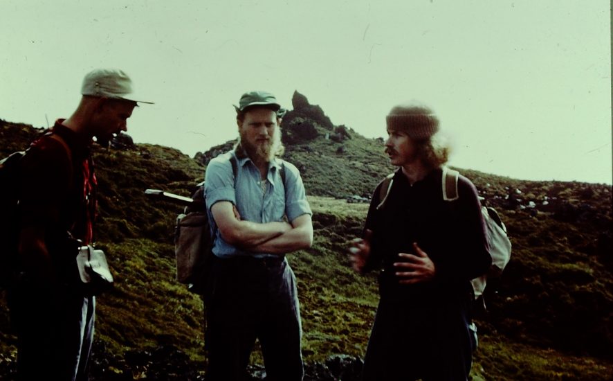
Wilhelm Verwoerd, Eduard van Zinderen Bakker, Junior and Brian Huntley confer inland of “Penis Rock”, Marion Island, March 1966
In January 1965 the First Biological & Geological Expedition sailed for Marion Island on the R.S.A., South Africa’s first Antarctic supply ship, then only three years old. The expedition was the brainchild of Eduard Meine van Zinderen Bakker, Senior, Professor of Botany at the then University of the Orange Free State.
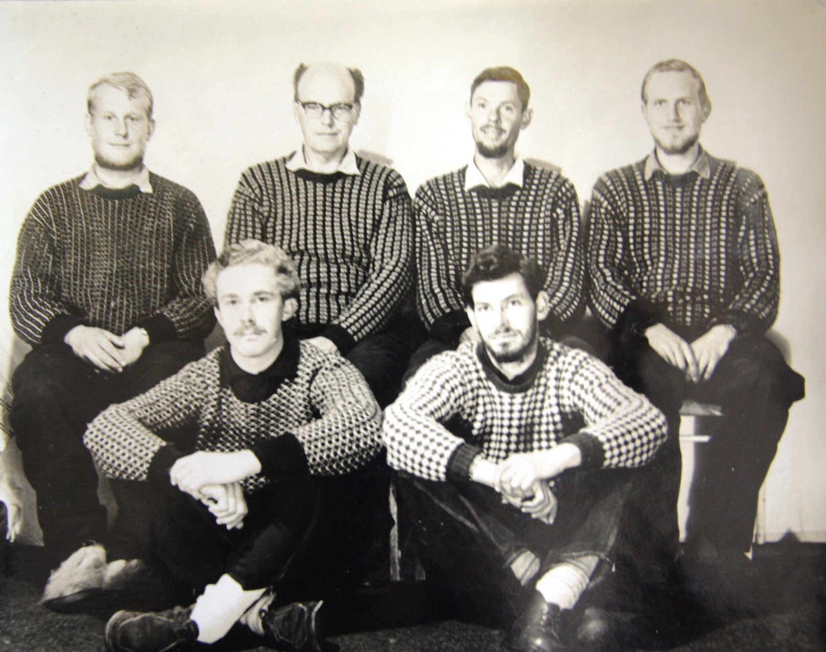
The six-man expedition joined Marion’s 21st Overwintering Team led by meteorologist Theo von Ludwig which was already on the island. Settling in for the summer – and converting an old accommodation building into the island’s first laboratory as an early task – field research took the intrepid scientists far and wide with heavy packs, camping out in tents and using caves and overhangs as shelters in the days before the first field huts were erected.
Surveyor Otto Langenegger (who had previously spent a year with SANAE’s Fourth Overwintering Team on the Antarctic Continent over 1963) and geologist Wilhelm Verwoerd, later at Stellenbosch University, undertook a trigonometrical survey, which resulted in the first detailed topographical map for the whole island being produced at a scale of 1: 50 000 by Wilhelm in 1968. A previous map by Alan Crawford (M1 Team Leader in the first half of 1948) only covered the eastern side of the island. During the survey they climbed most of the island’s peaks, erecting cairns and leaving markers on many of them. When producing their maps (a geological one was also made) names of team members were assigned to hills and peaks, including the island’s pet dog. So nowadays island visitors can climb “Oubaas” as well as Brian, Eduard, Lou, Neville, Otto, Stevie, Sydney, Theo, Wilhelm, Wolfie and Wynand.

Two other team members of M21, Chris Human and Cedric Roberts of the Public Works Department, did not have mountains or cones named after them. According to Eduard van Zinderen Bakker, Junior (the leader’s son who was also on the expedition) this is because “they were not on Marion from January to March 1965 while Wilhelm and Otto were doing their survey work. They departed with the R.S.A. to SANAE after we were dropped off at the island. Had they been on the island at that time I am sure Wilhelm would not have left them out”. This is confirmed by Wilhelm Verwoerd who also writes to ALSA: “One person whose contribution should have been recognised by us despite the fact that he was en route to Antarctica like Roberts and Human, was Johnny Strydom [SANAE 6th Overwintering Team, 1965], but unfortunately there was already a Johnny’s Hill! Strydom provided the base-line for our topographic survey by using a tellurometer to measure the distance between Junior’s Kop and Fred’s Hill beacons very accurately.”
Wilhelm also describes how names were chosen: “I was probably responsible for naming more features on these islands than anybody else. It generally falls to the lot of the land surveyor to name topographic features in any new survey. Where there are no pre-existing names he often has to rack his brain. Looking back, I think some of our best choices on Marion were descriptive names like Katedraalkrans [cathedral precipice] and Basaltgordyn [basalt curtain]. Others are really trivial, but catchy: what can be more so than Mixed Pickle Cove [named after sealers’ stores] and Santa Rosa Hill [after an enjoyed can of fruit]! Towards the end of our 1965 expedition we ran out of ideas and started naming our girlfriends, even Marilyn Monroe, the pin-up at the base, but better judgement prevailed and these were dropped before publication. Naming the highest peaks was a more serious matter. We followed a long-standing tradition in the Antarctic and on Sub-Antarctic islands like Gough by honouring heads of state, etc.”
The expedition made two short visits of a few days each to neighbouring Prince Edward Island, the first visit by scientists to that island. The maps then produced remain half a century later as the only ones available. Fittingly the highest point on the island was named after the expedition’s leader as Van Zinderen Bakker Peak.
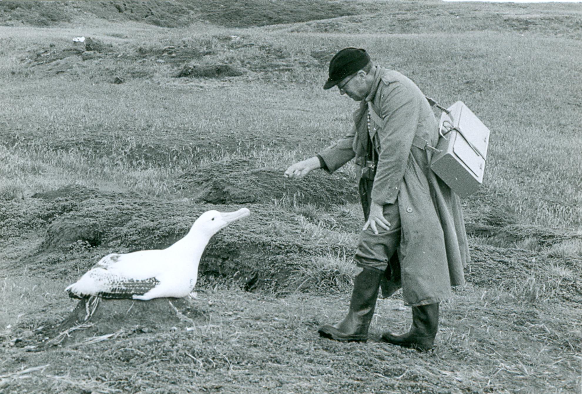
Most of the expedition left the island at the end of the 1965/66 summer on the annual relief voyage but two members, botanist Brian Huntley and ornithologist Eduard van Zinderen Bakker, Junior) stayed on for a second summer, eventually returning to South Africa in March 1966. During their extended stay Brian, along with M22 team member Fred Clements on 21 October 1965, made what is pretty certainly the first ascent of the island’s highest peak, named as State President Swart Peak, but now known as Mascarin on the island’s latest topographic map that has a scale of 1:25 000 and a contour interval of 10 metres. Previously, another peak (Jan Smuts Peak, renamed Resolution) nearby was regarded as the highest.
With grateful thanks to First Biological & Geological Expedition members Brian Huntley, Eduard van Zinderen Bakker, Junior and Wilhelm Verwoerd for their continued and willing contributions towards preserving South Africa’s Antarctic legacy.
References:
Huntley, B.J. 2016. Exploring a sub-Antarctic Wilderness. A Personal Narrative of the First South African Biological & Geological Expedition to Marion and Prince Edward Islands, 1965/1966. Stellenbosch: Antarctic Legacy of South Africa. 268 pp.
Langenegger, O. & Verwoerd, W.J. 1971. Topographic survey. In: van Zinderen Bakker Sr, E.M., Winterbottom, J.M. & Dyer, R.A. (Eds). Marion and Prince Edward Islands. Report on the South African Biological & Geological Expedition /1965-1966. Cape Town: A.A. Balkema. pp. 32-39.
John Cooper, Principal Investigator, Antarctic Legacy of South Africa, Department of Botany & Zoology, Stellenbosch University, 02 January 2017