A study by Prof Solomon Newete and Dr Khaled Abutaleb from the Agricultural Research Council (ARC), in collaboration with C∙I∙B Core Team member Prof Marcus Byrne from the University of the Witwatersrand, will help the City of Johannesburg Metropolitan Municipality to address the disparity in the urban green structure between the City’s poor and affluent suburbs.
Since the inception of planting street trees in France in 1850, mainly for their aesthetic value and as a symbol of modernity, they have been adopted as an integral part of urban planning and development in the contemporary world to serve beyond their traditional purpose. This includes reduction of urban pollution and the heat island effect, and the rising challenges of global warming. Many of the common street trees in European countries were also introduced into former colonies in Africa, the legacy of which is very much alive in South Africa.
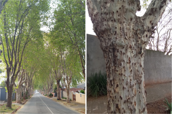
The city of Johannesburg is reported to have the largest artificial forest in the world, with anecdotal reports estimating it to contain over 10 million trees. Some of the most prominent tree species in the city’s streets include the common European Oak (Quercus robur L), London Plane (Platanus × acerifolia Willd.) and South American Jacaranda (Jacaranda mimosifolia), predominantly located in the most affluent suburbs of Johannesburg where the Europeans lived. As a result, many of the poor suburbs in the south such as the township of Soweto, as well as Alexandra in the northeast, do not have the benefits of street trees and parks. The City of Johannesburg Metropolitan Municipality plans to address this disparity in the urban green structure between the poor and affluent suburbs and therefore, mapping of street trees is of utmost importance for the metro to prioritize the future planting of trees to fill these gaps.
For their study, Prof Newete and co-authors mapped the tree canopy cover (TCC) of the two most common street trees, Jacaranda and London Plane using multispectral SPOT 6 satellite imagery acquired from the South African National Space Agency (SANSA). The accuracy of mapping trees at the species level, however, depends on the spectral and spatial resolution of the available satellite imagery and the classification algorithms used.
The classification results showed an overall accuracy of 88%, indicating a vegetation cover of approximately 66% in the study area, of which Jacaranda and London Plane occupied 18.4% and 19.6%, respectively. This suggests that if these two common trees make up only 38% of the tree canopy, Johannesburg is undoubtedly one of the most diversely afforested cities in the world, should the TCC of all the other tree species found there be considered. Many of these trees were found to occur in the affluent suburbs in the north of the city. The township of Alexandra had by far the lowest street tree density in the study area and is, therefore, one of the city suburbs that requires a tree planting programme.
“These findings would not only help to prioritize the increase of targeted vegetation cover in low cover areas, but it will also provide valuable information for the protection of vulnerable species such as London Plane from the threat of the polyphagous shot hole borer (Euwallacea fornicates) in Johannesburg,” says Prof Newete, lead author of the study published as a Scientific Report in Nature.
He adds, “The polyphagous shot hole borer is an alien bark beetle that can kill its host species, and due to the London Plane being one of the reproductive hosts of this beetle, the accurate mapping of these trees will facilitate with any future intervention measures.”
Read the full paper
Newete, S.W., Abutaleb, K. & Byrne, M.J. Mapping the distribution and tree canopy cover of Jacaranda mimosifolia and Platanus × acerifolia in Johannesburg’s urban forest. Sci Rep 12, 5998 (2022). https://doi.org/10.1038/s41598-022-09780-y
For more information, contact Prof Solomon Newete at NeweteS@arc.agric.za or Dr Khaled Abutaleb at AbutalebK@arc.agric.za
