The use and popularity of Google Earth has grown tremendously since its launch, and it has a range of uses from mapping and viewing mountain bike routes to monitoring chimpanzee forest habitat. However, Google Earth had no formal recognition or guidelines for its use in the field of invasion science, despite the fact that many scientists and managers use it on a regular basis. The lack of formal sources of information on how to use Google Earth effectively in research projects provided the motivation for a research paper that provides helpful hints and tips for the use of virtual globes, such as Google Earth, in invasion science.
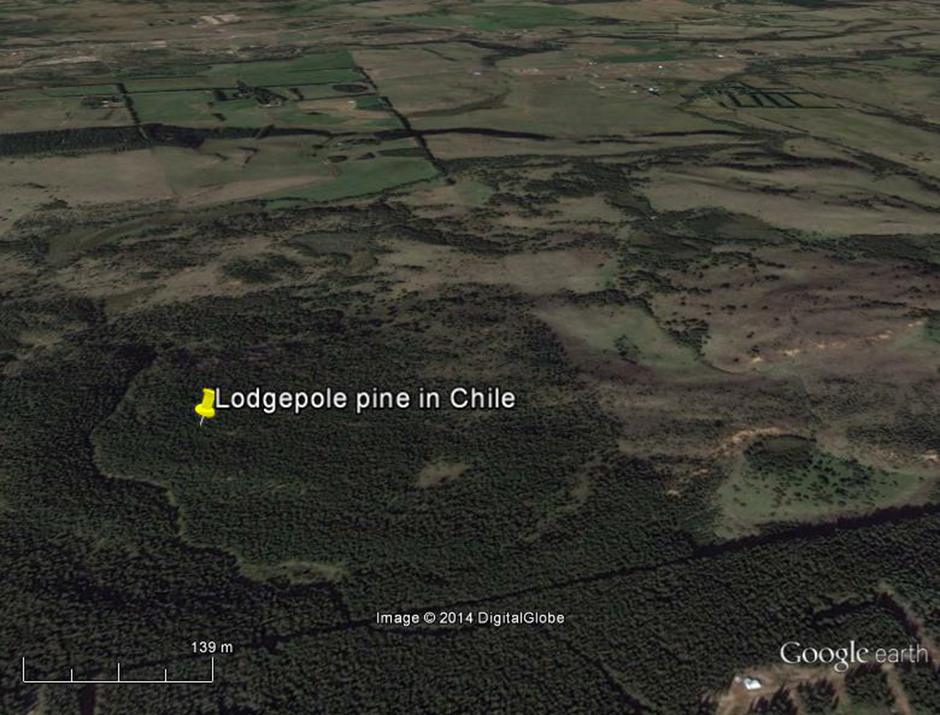
The paper, led by C·I·B researchers Vernon Visser and Dave Richardson, shows how Google Earth can be used to map tree invasions, monitor their progress and to identify field sites. The authors also used Google Earth for awareness raising and sharing of information online. For this, the authors developed a Google Earth dataset that highlights some impressive tree invasions in ecosystems around the world.
Further work is now underway to set up a global network of sentinel sites to monitor alien tree invasions, for example, from commercial alien tree plantations, botanical gardens and suburbia that are situated in largely treeless areas. The authors also provide a smaller Google Earth dataset for the south western Cape of South Africa, of the type of network they would like to see ultimately developed for the entire globe.
Read the paper
For more information, contact Dr Vernon Visser at vernonvisser@sun.ac.za